
SENS collaborates with Mistawasis Nêhiyawak on flood projections
In the spring of 2011, following an extremely wet winter and heavy rainfall, the Indigenous community of Mistawasis Nêhiyawak was devastated by a major flooding event that was described as one of the worst since 1956.
By Megan EvansSince then, the community —located 70 kilometres west of Prince Albert—has experienced cycles of seasonal elevated water levels. At Turner Lake, which is fully contained within reserve boundaries, the water levels have risen approximately seven feet over the past five years. Increased water levels have ruined infrastructure previously used in the community to prevent flood damage and has created negative social and environmental impacts, notably, a reduction in the quality of source water.
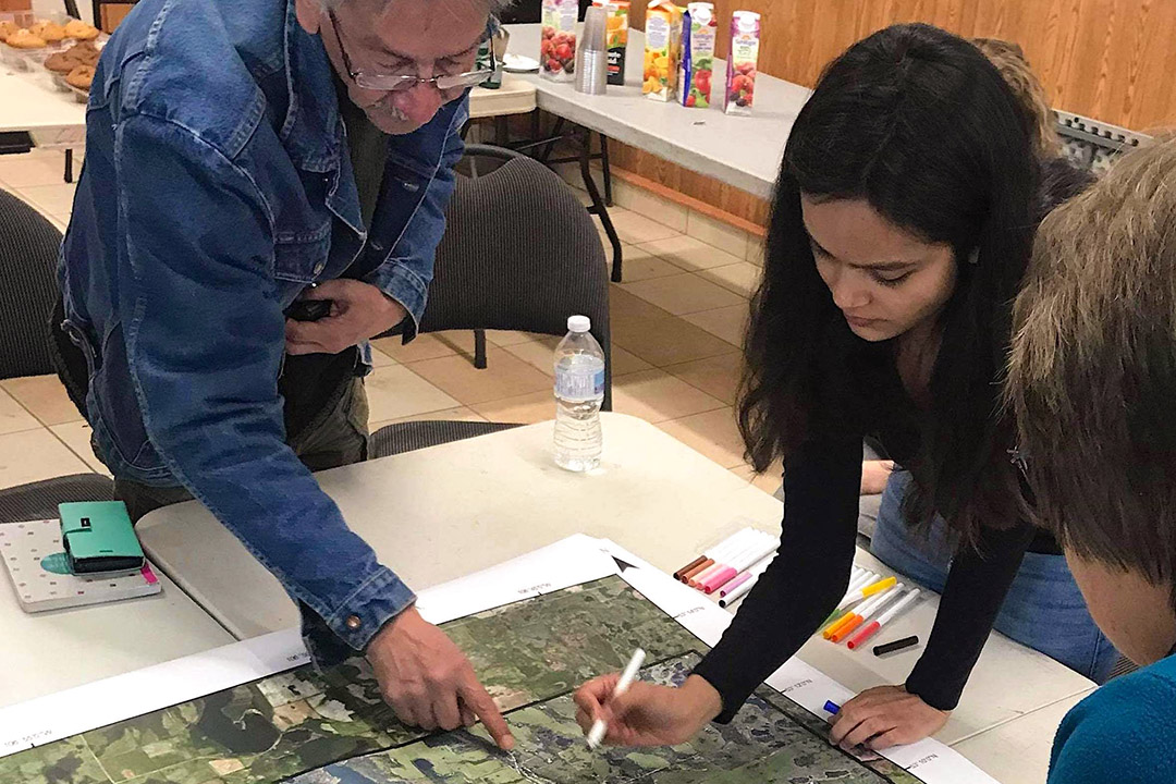
In the spring of 2014, after Mistawasis Nêhiyawak experienced another major flood, a light detection and ranging (LiDAR) survey was performed for the community to identify water features on reserve for land-use planning. For years, however, the community was unable to put the data to use, until Anuja Thapa, a second-year student in the University of Saskatchewan’s (USask) School of Environment and Sustainability (SENS) master’s degree program, took an interest.
Combining advanced hydrological mapping with engaged community scholarship, Thapa delivered a series of maps forecasting levels of flooding that can be used by emergency planners in Mistawasis Nêhiyawak to prepare for future flood and evacuation scenarios. After the maps were made available, Thapa studied how discussions about flooding in the community moved from reactive and risk-based language, to prevention and building resilience. Through her approach, community members were able to use their data and add details that hydrological modellers and geographic information system specialists might miss.
“Maps don’t show traumatic experiences or tell you the anxieties community members have about the future,” Thapa said. “Not all models are perfect, but if we make the consultation and research processes transparent, we can identify where there may be gaps. There is more than one way (or method) of doing things as long as our research is credible, inclusive, and fair. We need more than one voice in this era of growing concern and urgency of climate change.”
The collaborative mapping project—supported by the Canada First Research Excellence Fund—accurately predicts the extent of flooding near the community’s schools and evacuation centre, and helps predict how an evacuation route will be affected—an important piece of the puzzle given that the reserve has only one main road.
Anthony Johnston, SENS Indigenous mentor, special projects worker, and spokesperson for Mistawasis Nêhiyawak, feels that the project was successful on most fronts, and challenging on others. As a rural Saskatchewan reserve, the community is still building the resources, expertise, and experience to deal with flooding and other water issues on their own.
“In past years, while we were dealing with flooding on a daily basis, we may have taken actions that impact present or future water use and quality,” he said. “In one case we needed to divert waters into one of our pristine lakes. This resulted in higher lake levels that caused shoreline damage and killed shoreline vegetation and trees. Now we can only wait and see if we did more harm with our quick solution. We might have decided differently if we were able to use our LiDAR data earlier.”
With the completion of the first phase of the mapping project, the community hopes that the information can be used to make better choices in the future.
“In recent years we have been working towards a better connection and understanding of land, water and sky that our ancestors had,” Johnston added. “We now have 21st century tools to better connect and understand. We hope that the children and youth will be the ones to bridge past knowledge to deal with present-day issues for a good future with all that share our traditional territories. On a local, regional and provincial basis, we need to consider future impacts to our present actions or lack of action.”
New projects are planned for the future with Mistawasis Nêhiyawak and SENS, a collaboration that has been an opportunity for SENS students to learn first-hand about reconciliation through shared science.