Wildfire season: is this the new normal?
Rapid melt of near-record snowfall in the Rocky Mountains in the spring caused serious flooding in parts of B.C. This summer, the drought and high temperatures have led to a very different situation.
By Mark FergusonThe mountains surrounding Canmore, Alta., are obscured by the smoky haze from the outbreak of western wildfires in British Columbia and Alberta this summer. (Photo: Robert Sandford)
More than 500 wildfires were still burning in B.C. in September, with the Yukon, Alberta, Ontario, Quebec, and parts of the Atlantic provinces all experiencing one of the worst fire seasons in history. Globally, wildfires in the United States, the United Kingdom, Spain, Portugal, Greece, Sweden and Australia are burning at an alarming rate.
According to John Pomeroy, Canada Research Chair in Water Resources and Climate Change and director of the University of Saskatchewan-led Global Water Futures Program (GWF), this is a horrific year for wildfires not only in Canada, but around the world.
“You do not expect extensive wildfire in Swedish mountain tundra or in Welsh mountains, but we see that this year,” said Pomeroy. “This is further evidence of remarkably fast changes in climate around the world as a result of new extremes of heat and variable precipitation, due to human-introduced greenhouse gasses.”
Pomeroy points to a number of factors that have led to these severe fires this year, including an extremely dry and hot summer, and dead forests ravaged by the invasive pine beetle—a creature that continues to thrive in warmer winters, especially in the B.C. interior.
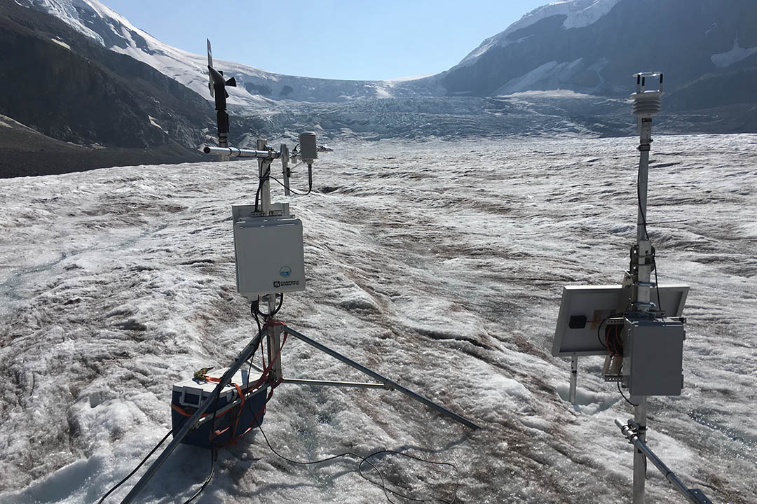
These fires are also sprinkling ash across the Columbia Icefield and glaciers that make up the headwaters of the Saskatchewan, Mackenzie, and Columbia River Basins. This ash will likely speed up the melt due to the increase of solar radiation on the glacier, whereas clean ice would reflect the sun’s rays.
“This is the darkest I’ve seen the Athabasca Glacier in my life,” said Pomeroy, who has been studying hydrology in the Rockies since the early 1980s.
In nearby Canmore, Alta., Robert W. Sandford, a Fellow of the U of S Centre for Hydrology, and EPCOR Chair in Water and Climate Security with the United Nations University, described the situation in a different way.
“The sunrise in Canmore on the morning of Friday, August 17th, 2018, was surprisingly smoky in a way that made it eerily reminiscent of some of the sci-fi doomsday thrillers of the 1980 and 1990s,” he said. “We are now seeing the direct climatic connection that climate scientists have been talking about for years, between water and its diametric and symbolic opposite fire. If you don’t have the former, then you get the latter. Higher mean annual temperatures, especially in northern Canada, are already resulting in increased wildfire risk.”
According to Sandford, a decade ago scientists predicted a whopping 75–120 per cent increase in the amount of area burned each year, and now it is happening.
“We are also seeing once again this year that a slower and wavier jet stream is causing the conditions that exacerbate the wildfire threat to intensify and persist longer in vulnerable places. As a result, fires are already becoming bigger, hotter and faster. Just as scientists predicted, methane releases have accelerated from the thawing permafrost of the Arctic. We now have forest fires that are fueled by the methane they release,” said Sandford.
Many researchers involved with the pan-Canadian GWF program are studying this situation with increased urgency. Addressing risk factors is critical moving forward, according to Pomeroy.
“The risk of fire can be predicted with coupled climate and water models,” said Pomeroy. “For instance, the exceptionally low snowpack and dry soil moisture or dry duff layer under the forest canopy that led to the Fort McMurray fire in 2016 was predictable by our models. Once the risk of fire is high it is harder to say exactly where the fire will start because the start is often from a dropped match or a spark from a vehicle or a lightning strike. But it is possible to say where the risk is high.
“Risk can be mitigated by reducing the density of forests where there are communities, mines, roads and infrastructure right next to the forest. We often have very dense, old forest canopies right next to boreal forest and mountain communities and these are very dangerous situations given the recent increases in wildfire in Canada. We also need better prediction of risk of fire so that fire bans and other preparations can be made when risk is high.”

